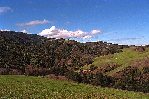
The highest of the loop trails inside the park, it's a bear to hike no matter whether you go up or down. The reward is sitting on a bench at the top of the trail, sitting under a power tower looking out over the Santa Clara Valley (see photos below). At that point you are 1600 feet above the mess below you.
 |
This perspective, taken from the hill near the split of the PG&E and Coyote Trails, gives a great overview of the park. Rolling your mouse over this image, the power towers marching up the hill are marked with the line at 2, while the approximate top of Black Mountain is 1. Wildcat Canyon is 3 and 4 is the Upper Wildcat Canyon Trail, which makes it's sharp turn and runs up under the Upper High Meadow. The Wildcat Canyon Trail trail intersects with the Upper High Meadow trail and sort of runs along the ridge line, stopping when it intersects with the top of the PG&E Trail. Taking the Upper High Meadow trail is my preferred way to get to the top. Rogue Valley with the houses in Los Altos hills showing is marked as 5.
| Sometimes it is nice to get a perspective from a distance on where you are hiking—this is the top section of the PG&E Trail as seen from the Wildcat Loop. | 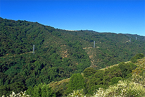 |
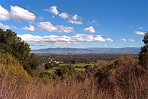 |
Perspective is nice too when you get a chance to look at what you are hiking out of. This is the Santa Clara Valley and the southern portion of the SF Bay. From here it looks like a sunny balmy day. Many decades ago this photo would have been of orchards of fruit trees. |
| The PG&E Trail only runs along the power towers. You can pick up the lower end of the trail from the Equestrian parking. Climb up the hill and take the left hand fork when the trail splits—the center fork being the Coyote Trail taking you to the farm and the right fork taking you past the water tank to a particularly short and steep down to parking lots. The PG&E Trail heads up hill to the power towers. These towers are fascinating, especially in contrast to the oak trees and their varied forms. | 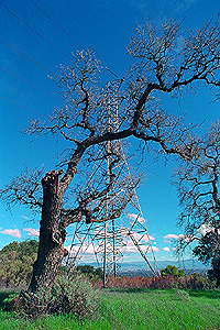 |
The trail heads up the first hill and then dips down to where there is a cut off to the Wildcat Canyon trails (another way to hike up to this route...), then the ugly part starts and continues along to the vista point and bench where the trail ends and joins the Upper High Meadow Trail. I have not talked to anyone who has actually enjoyed this trail, especially on a hot summer afternoon. It is wide. It is dusty. It is steep. There are a couple of places where the trail cuts into a canyon and there is cool shade, but even then... It's obvious that this was a road cut to construct the power towers.
Here are some views from the top. Picking a great day for pictures is hard, as it is often hazy and dull looking down on civilization:
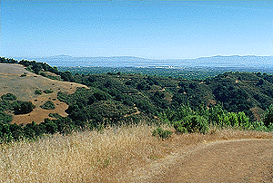 Mt. Diablo and Sunol, note Upper Wildcat Canyon trail winding up below Upper High Meadow | 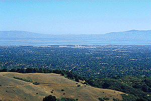 Moffett Field, Upper High Meadow and trail in foreground |
|
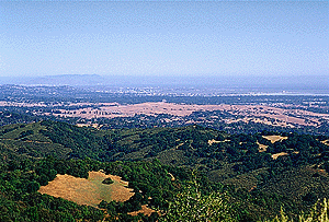 Mt. Tamalpais and the north bay, looking over the Stanford dish, which used to have good hiking |
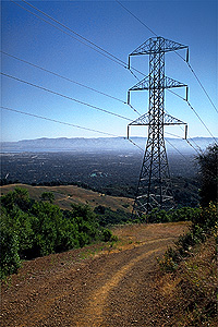 Power tower and trail |
|
These images were taken about ten a.m. on what turned out to be a smoggy day. One of these days I will go up there very early or very late on a clearer day to catch more interesting light and maybe a moonrise.
Fortunately there is another way to the vista point. Up the High Meadow Trail to the Upper High Meadow Trail. This trail is steep in parts, but not nearly as bad as the PG&E Trail itself. The Upper High Meadow is gorgeous and there are fewer people on this section. Before it meets the PG&E Trail you get a look at the trail up to the top of Black Mountain.
Once you are through this, it's back to the farm and then your car. . .
And this time you may want a cold drink.
Return to the Rancho San Antonio page.